Enhance Situational Awareness for First Responders with Indoor 3D Mapping

Fire fighters at the scene
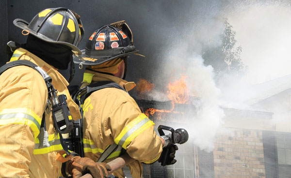
  • Enhanced Situational Awareness Emergency Response Solution Provider
  • Innovative Indoor Maps to Manage Facility & Site Area Data
  • Visualize Cameras, Alarms, Sensors, Alerts, and IoT Systems
  • Partnered with GeoComm’s Cloud-Native Map Viewer and Indoor Mapping
  • Security Expert Eric Kant of Kant Consulting Retained as Consultant

Maptelligent provides indoor mapping capabilities for facility managers and public safety-first responders to ensure safer more efficient physical environments for schools, businesses, universities, and hospitals. MAPT has a team of experienced former first responders, emergency managers, and armed services professionals who have combined their boots on the ground knowledge with business experience obtained from working at leading technology providers.

The MAPT mission is to provide information and data interoperability enabling organizations to quickly share information during a time of crisis. MAPT uses a geographic platform to access site-specific information enhancing physical security and facility management.

Visualize and Access Data About a Facility

Emergency rescue operation in progress

MAPT innovative indoor maps provide the ability to visualize and access data about a facility and the surrounding area so that clients have all the data they need to make life-saving decisions quickly and efficiently. No matter the size of the facility, MAPT provides the tools to support a smart building. Whether the task is collecting maintenance logs, or providing assessment of security risk and vulnerabilities, MAPT delivers what is needed.

MAPT platform enables integration with popular cloud enabled cameras, alarms, sensors, alerts, and IoT systems providing immediate context. When an alarm sounds, the client immediately knows where it’s located and is able to see which cameras have the best view of the situation.

Solution Innovation

On June 3rd MAPT issued an announcement covering its current emergency response solutions. MAPT continuously strives to develop solutions to ensure information is readily available to effectively respond to emergency incidents involving facilities where large numbers of people gather. 

Recent MAPT work with a school district in the mid-west validates the importance of providing cloud-based solutions to enable information with public safety/first responders.  The increased number of mass shooting incidents being reported in the national news validates the need for the technology and partnerships MAPT has developed.

MAPT has shifted from a desktop application to the cloud and mobile based solutions to ensure customers have the information they need when they need it.  MAPT is planning to demonstrate its capabilities to a mid-west countywide school system later in June.

MAPT is also launching a new website with a new logo, new brand, and a better way to deliver solutions to customers driven by e-commerce and digital engagement methodologies.  The new website will officially be launched in June 2021.

Agreement With GeoComm, Inc.

On April 13th MAPT announced an agreement with GeoComm, the leading provider of Public Safety Location Intelligence, to sell GeoComm’s cloud-native map viewer and indoor mapping capabilities to the first responder and private sector market.

MAPT will provide the physical security and facility management market with GeoComm Maps and GeoComm Indoor Maps to visualize building floor plans and site assets on cloud-native map displays.  

The MAPT collaboration with GeoComm will ensure first responders, facility owners/managers, and security directors can more effectively pre-plan emergency responses with a higher degree of site situational awareness for a healthier and safer physical environment.

The introduction of GeoComm’s Public Safety Location Intelligence Platform into the MAPT product portfolio will provide MAPT customers with the ability to begin their journey into smart building solutions using a software-as-a-service buying model.

“GeoComm is excited about the partnership with Maptelligent, leveraging our Public Safety Location Intelligence Platform. This is just another example of how a public safety grade, cloud-native platform can be leveraged by our partners in support of a common mission, getting the right location data, to the right person, at the right time.

With the increase in wireless caller location accuracy, and the demand for indoor maps to provide greater situational awareness, Maptelligent’s solution provides value to their facility management customers as well as the local public safety agencies who will be able to access the indoor maps, providing a safer environment through enhanced response,” Erik Loberg, Vice President of Public Safety Applications.

Security Expert Eric Kant of Kant Consulting Retained as Consultant

On February 8th MAPT announced the official engagement as a consultant with Mr. Eric H. Kant the founder of Kant Consulting Group, LLC, providing over 26 years of tactical guidance at significant events and disasters worldwide.

Mr. Kant provides a robust expertise in cyber security, data science/analytics, interoperability and technology domain awareness, communications, integrating advanced technologies and communication systems for deployment of strategic command and control, and intelligence operations.

Mr. Kant will assist in the development of MAPT capabilities including web design, eCommerce platform, applications, and a means to collecting attribute data. 

Mr. Kant has directed multiple presidentially declared disasters in central Florida and responded to the first attack of foreign terrorism on US soil to include lending his expertise at the World Trade Center Disaster in NYC.

Response to Significant Events

In addition, he has provided operational and technical expertise in response to, some of the most significant events and disasters of the past two decades such as multiple National Special Security Events, Olympic and World Cup Games, four Super Bowls, Republican National Conventions, Democratic National Conventions, the G8 summit, as well as many other national/international security events and natural disasters including hurricanes, tornadoes and wildfires.

Recent projects include DHS Intelligence & Analysis, DOD, Department of Homeland Security Science and Technology including recognition by NATO for innovation and the National Geospatial Intelligence Agency disparate data challenge.

Mr. Eric Kant, the founder of Kant Consulting Group, stated, “We’re excited to partner with Maptelligent and expand on its latest vision to provide clients greater understanding through interoperability. The partnership is a powerful combination. Kant Consulting Group’s understanding of innovation, its deep integration expertise, and collaborative methodology is uniquely complimentary to Maptelligent. 

We know this will generate industry leading technology products and platforms, the combined team has broad experience in designing, planning and implementing advanced solutions, having worked together, in partnership, at past national disasters & special security events gives us a unique edge, no other team can match.”

Source: maptelligent.com
0 Comments